The Kineret and the Yarden

 Ahuva has a work thing on Friday so we decided to do a Thursday hike. It's a very light week of work for Gershon and me so we were easily able to take off and Shira and Ahuva were able to get the day off too. In mapping out the hike, we couldn't find a good place to end. We're pretty comfortable walking about twenty kilometers each time but there was nothing that looked convenient. We figured that we'd play it by ear a little. We put in something called Chaim B'Teva to WAZE hoping we'd be able to park there. That would be about 16 kilometers but was the best we could do without going to far from the shvil. We met at about 6 but were afraid to drive it in the dark. The "road" was very rocky and we weren't sure our cars would be ok. So we decided to park at a school near the path. It was about 2 kilometers off the shvil. So our hike would be 18 even though we'd only be doing 16 on the shvil. 

We drove back to Yaar Shveitz together to start our hike. The forest is very pretty with beautiful views of the Kineret. We started walking a few minutes before 7. Overall, the walk was very easy and mostly on wide paths. We've noticed though that there are fewer markers when you're walking on those kinds of paths. We got lost a couple times. Actually, lost is the wrong word. With all the maps we have on the phones, it's hard to get lost (though I'm sure it's not impossible) but we went off the path. In total we probably walked about two kilometers off the path until we got back going the right way. It wasn't awful but was the worst we've done with it. 

We continued our trek south which is the direction we've been walking almost all the time. We got to the bottom of the Kineret and then walked along the Yarden for a little while. The picture is at Rob Roy which is a canoeing place we'd been to a couple times right at the top of the Yarden. Then we turned right to start heading west. The next few hikes will be mostly west until we get near the coast. 

Gershon said that this was his favorite hike so far. It was very pretty and the weather was perfect though it was quite muddy in some places. As mentioned, it was easy most of the time until the last couple kilometers on the shvil. We climbed a mountain and then walked through some relatively rough terrain. We saw some ducks along the way and lots of cows though we didn't get too close to any of them. Last time, I pet a cow but this time I didn't have that opportunity. In the end, we walked a little more than 20 km and it took us less than six hours. 


Mount Arbel

 One of the challenges of planning the monthly hikes is figuring out where we should end. It would be great if we could just start walking and end at a certain time or when we feel like we've had enough but because we park one car at the end point, we need to decide that before we leave. Sometimes we cover as little as two kilometers in an hour and others as much as five so it's very hard to estimate. We seem to average about 3 km per hour which seems very slow but, including our very short stops and time we spend doubling back because we missed a turn or whatever, that seems to be our average. Given the short Friday and the still relatively long drives, we decided that about 15 km was the right amount for this hike. In the end we found a place to park 16 kilometers after our starting point and figured that was perfect. 

We met at our ending in the middle of the Schweitz (Swiss) Forest which had some sentimental value to Ahuva since some of her family comes from Switzerland. We got there around 5:15 and then drove together to our starting point in Migdal. We davened and were on our way by 6:10. That was about twenty minutes before sunrise but by that hour it's light enough that you can start hiking. This was especially true this time because the beginning was walking through the city of Migdal where it was very well lit. 

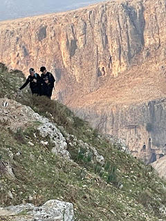
After a kilometer or two, we got to the base of Mount Arbel. We don't do any advance scouting and really never know what we're going to hit on the hikes so it's always a surprise to us. First there were steep steps going up. It was tiring but not difficult and we were doing great. That only got us halfway up the mountain though. Then it was more difficult climbing. There were some bars to grab but a lot of the time it was just holding onto rocks. For people with a fear of heights this proved to be scary but we all did great and got to the top of the mountain. I don't clock every section so I don't know our exact speed but I'd guess we went no more than 2 km per hour up the mountain (including stopping to wait for stragglers or to rest). 

By that point, I was starting to get a little nervous about time. We had a 30 minute drive back to our cars and then a 2+ hour drive home. Candle lighting was 4:16. We were each having company and had stuff to do to prepare for Shabbat. Luckily, there was no steep decline to get down Arbel and we made excellent timing. We walked on the edge of Kfar Hittim and Mitzpe before walking for a while in the city of Teverya Ilit. Then we got to the Swiss Forest and walked the last 3 km or so on walking/biking roads in there. 

Besides the climb up the mountain, the walk was very easy overall and we made great timing. We covered 16 kilometers in about 5 hours. We were home before 2. I really enjoyed this hike and if I were to rank the hikes we've done so far this would probably be number 1. The views of the Kineret were really nice and the temperature was perfect. 


For Fit People Only

There was no Friday in October that worked for all of us because of the chagim and travel schedule so we all agreed that we'd do a Sunday. This worked to our advantage because it gave us a longer day and was right after we changed the clocks and gained an hour. It also helps that we are closer to home than we were when we started. 

We agreed to meet at our endpoint at the Dalia Tavern in Migdal at 5:10. The drive was less than two hours for us so it meant that we could sleep until almost 3 which was the old 4. Not too bad. We met the Seiferas' there and then drove together to Kever Rashbi where we davened, ate breakfast and started the trail at 6:15. Because of the extra time we had, we decided that we were going to do about 22 kilometers according to the websites we were using. 

The first two or three kilometers weren't too bad. It was nice that it was pretty cool when we started (Gershon and Ahuva even had on sweatshirts). Some hills and lots of rocks but nothing too strenuous. Then we came to a big warning sign that said that the next 9.5 kilometers are extremely difficult and only fit people should plan to do the hike. We decided that the four of us are in good enough shape that we could do it. We did pretty well overall and our problems weren't caused by the fact that we're not fit enough. We really had two major problems. The first was that Shira is terrified of heights and doesn't go downhill very well. This meant that she went very slowly every time we had to climb down and she was really scared. She did it though (some sliding down on her tush)! The other issue was that at some point Ahuva twisted her ankle and by the time we had finished about 60% of our hike, she couldn't walk on it anymore. 

We were at a parking lot right next to highway 85. She could not continue. We had two choices: 1. Take a taxi/tremp to one of the cars or 2. Shira and I finish the hike and pick up the Seiferas'. The only reason the second choice was even an option was because this entire hike is part of yam l'yam and they just did that hike with some of their family a few months ago. So even if Shira and I did it ourselves, the Seiferas' will still have done the entire shvil. They said that they really didn't mind waiting so Shira and I went to finish the last 10 km. 

Google Maps assumes you can walk 5 km per hour so it said it was a two hour hike from there. When walking on a road, that's no trouble at all. Luckily, the last ten miles of the hike was easy (at least relative to the previous 10k) but it's still on rocks with a little climbing. We didn't stop and tried to walk as quickly as possible but it still took us a little more than 3 hours to finish. Shira twisted her ankle and fell at one point but she got right back up and wasn't hurt badly. We then went to pick up Gershon and Ahuva and drove back to the beginning point. 

We only saw one cow (and it was missing a horn - or maybe it was a fat unicorn) and a bunch of wild boar.  The first time we saw them, someone pointed them out to us and said that there were chazir bar over there. It sounded a little like he said Ribar but alas it was just a bunch of wild pigs. Then Shira and I came pretty close to one later in the hike. We saw more people than we'd seen on previous hikes - most people aren't dumb enough to hike in the summer heat. We saw a Swiss woman who was doing the entire shvil yisrael by herself over a few weeks. We also saw a group of girls doing the entire shvil. We saw a few people doing yam l'yam also. We even passed a group of school kids eating lunch. 

Shira ordered special t-shirts for us for the shvil Yisrael. We only gave them to Gershon and Ahuva at the hike and it was too cold to change so only Shira and I wore them as you can see in the picture. 


Kever Yeshayahu to Kever Rashbi

 We were initially supposed to do leg 3 of the shvil last Friday but the forecasts said it could hit 100 degrees. After the difficult time we had the previous week, we decided that it was better to push it off a week than to die. We decided that this leg would be from Kever Yeshayah to Kever Rashbi which was about 4 kilometers shorter than the previous hike. We also chose to meet earlier and to start the hike as close to sunrise as possible. The drives are getting shorter so we could do it. 


We met at the ending point at 5:15 and then drove together to the start where we davened and ate a quick breakfast. We were on the shvil by 6:20. Overall, the hike was mostly uphill but wasn’t too bad. There were two tunnels that went under roads and those were fun and different. As usual, we hardly stopped and just walked straight. We’ve discovered though that we really can’t expect to cover more than 3-3.5 km per hour. We’re walking on rocks and going up and down hills. You just can’t go that fast. 


We saw lots of cows as usual and we actually saw a group of Arab women hiking so it was nice to see people.
Overall, it was pretty uneventful. We finished the hike around 12:30 and headed home.

We are making nice progress. I’ve been looking at https://mapateva.org.il/Apps/StoryTelling/PlayList_IsraelTrail/ a lot to map out the hikes and they have the shvil divided into 48 hikes. The first one was canceled so it’s now only 47. We’ve gone three times but have done four of the sections. Initially, we thought we’d hike over the chagim but it looks like we will probably wait until the end of October for our next hike.


That was tough

 It took us a long time to finally do the second leg of the shvil. Between vacations, work and covid, we had a lot of difficulty finding a Friday that would work for all of us. We found one though and decided that this time we were going to get an earlier start. The problem is that we aren’t following anyone’s hike exactly so we’re trying to figure this out on our own. We knew that we were starting at metzudat Yesha, where we left off last time and we knew there was parking there. The question was where we would end. I looked for a few places and finally settled on kever Yeshayahu. I wasn’t sure there was parking there but it was right on the trail and next to a road so I hoped there was parking or we’d have to look for parking along the way. Google Maps said if we walk along the trail it would be 22.8 km which seemed do-able. 


Our plan was to meet at kever Yeshayahu a little before 6 and daven there and then drive together to the starting point. We left our house at 3:50 and the Seiferas’ left about a half hour earlier and we were right on target. We got there, davened and drove. Then we hit our first snag… we couldn’t figure out where we should go. I think we wasted at least fifteen minutes trying to get that but we got it and we were off a little after 7 AM. Google maps said it should take 5 hours. I couldn’t imagine it would take us more than 6 so we’d finish by 1 and all would be good. We were having a lot of company for lunch the Seiferas’ were having a ton of people for dinner. Even though we had all basically finished cooking, we still wanted to finish by 1 so we could be home around 4. 


The beginning of the hike was very hard. The paths were very rocky, through bushes and stuff with a lot of steep hills going up and down. A couple times we walked a little bit past the path and circled back but didn’t waste too much time doing that. At one point, we couldn’t find how to get to the continuation of the path. We saw where it was but there was a gate and we couldn’t figure out how to get to it. After a while, we found a way and continued. I slipped on one of the declines but I just scraped my leg a little and was fine. Overall, the first couple hours were hard but it wasn’t too hot yet and we felt that we were doing well.


We could see on the map that shvil yisrael goes in a circular path when walking straight would have been much faster. We are following the shvil and not cheating so we did that. 

It would have been much closer and easier to follow the red line straight across instead of going south and north but we’re not cheaters so we stayed on the path. Around the time we got to the top of that bend and we were back near the highway, we decided we should when google maps thought that we’d get there. It was probably around 11 and I thought we had two hours left in the hike. We were very disappointed when it said we still had almost three hours left! That meant that we had only completed about 40% of the hike and it had already taken us almost 4 hours. We started talking about possibly taking a cab to the car and continuing next time. Ultimately we decided that if picked up our pace a little we could make it to the car by 2 and still be home by 5 which would give us enough time. 


To give some background: when Shira and I walk quickly without a stroller and without stopping, we do about 7000 steps in an hour. 1000 steps is approximately .75 km. These are our steps per hour for the hike:

7 – 4700

8 – 4000

9 – 5200

10 – 5200

11 – 4600

12 – 5300

1 - 5300 


You can see that the second hour was extremely challenging. Despite the fact that we were exhausted in the last two hours, we really picked up our pace and covered a lot of ground.


Thank God, the rest of the hike was relatively easy and we got to the car a little after 2. We were all (though I admit that I was probably a little worse than the others) completely exhausted when we climbed into our car. We drove back to the starting point so the Seiferas could get their car and got home about two hours before Shabbat started. 


The hike took us about seven hours total and we ended up walking at least 25 km. We didn’t see a single soul walking anywhere along the hike. We only saw one person the entire time and he was on a tractor. We did see a lot of cows and hyrax though. 


Gershon suggested that next time we get started even earlier and we limit it to about 15km. I agree. Hopefully next time will be in just a couple weeks. 


We actually started!

 After some negotiating on the times we decided to meet at the end of the trail at 8:15 AM. I was able to do the daf and go to netz minyan and then leave. We were on the road around 6 and got to the Metzudat Yesha around 8:10. We paid 35 shekel and took highway 6 to save about 25 minutes. Seiferas got there a few minutes after us. They were exhausted because they had a super late night Thursday and got very little sleep. We climbed into their car and drove to the Pesel Aryeh Hashoeg. It was a 20 minute drive mostly north and through Kiryat Shmona. We thought about checking out the lion but decided that we didn’t have time and we should get started. We started the trail at 8:50.


We were relying on shvilist.com and it said it was an 18 km hike and should take about four hours. We figured that it might take us longer but we should be able to do it in under five hours. We walked at a nice pace and barely stopped. I think we stopped twice - once for water for about two minutes and once we had melon and vegetables for about ten minutes. We saw lots of cows and bulls and one very big snake. We tried following the markers for the shvil yisrael. Most places were clearly marked. At one point we must’ve missed the marker because all of a sudden we didn’t see one so we doubled back and found the missed turn. That was probably about a half kilometer of extra walking and cost us a few minutes. 


For almost the entire time I walked with Gershon while Shira and Ahuva walked together. Most of the time the men were in front but often the women went ahead. We all walked the same pace and were generally just a few strides from each other. We really didn’t stop to look at anything though there were some nice views. 


At around 1 PM, we figured that we should be finished and I turned on Google maps. It said that we still had more than FIVE kilometers to go. None of us could believe it. We were really starting to tire but at least now we knew exactly how much further we had. We got to the ending point at 2:20. So it took us five hours and forty minutes which was far longer than we expected but it turned out that we had walked more than 23 kilometers. We have no idea where we veered from the path but somehow we added at least five kilometers to our hike. Next time, we need to prepare a little better and maybe even bring a map with us. 


We then drove the Seiferas’ back to their car and drove home. We got home at 5 PM with just enough time to get ready for Shabbos. Thankfully, we were going out for lunch and were only four for dinner. It was a very enjoyable day and we are anxiously waiting for the next stage of the hike. 


Shvil Yisrael

I'm restarting this blog to tell about our adventures on Shvil Yisrael

[8:46 AM, 3/16/2022] David Greenstone: Shira and I have been talking on and off about doing the Israel Trail (walking the entire country from north to south). There are numerous problems but the main two problems are the amount of time and the fact that I hate sleeping outside. So we figured out that we can do it in shifts. You basically walk small chunks one day a month for 5-6 years and then you finish the whole thing. Others do it like that and it works. We thought it would be more fun if we had friends doing it with us. that's where you come in. When should we start? 
[8:49 AM, 3/16/2022] Ahuva Seiferas: That's awesome!! Only problem for me is that I'm never off from work other than Fridays. Probably not so feasible, right? 
[8:50 AM, 3/16/2022] Shira: We would want to do it on Fridays. Can you make that work? We would have to take vacation if it was any other day. 
[8:50 AM, 3/16/2022] Ahuva Seiferas: ooohhh....very tempting. not that i'm ever ready for shabbat in advance...when would you guys want to start? 
[8:51 AM, 3/16/2022] Shira: the first part is in an open area, so best to start before it gets too hot 
[8:51 AM, 3/16/2022] Shira: it's all the way up north. so would require a lot of organization on the home front 
[9:10 AM, 3/16/2022] Gershon Seiferas: Interesting! 
[9:10 AM, 3/16/2022] Gershon Seiferas: Year round? 
[9:14 AM, 3/16/2022] David Greenstone: Yeah 
[9:15 AM, 3/16/2022] Gershon Seiferas: Every week? Or x times per month? 
[9:15 AM, 3/16/2022] David Greenstone: probably once a month 
[9:15 AM, 3/16/2022] Gershon Seiferas: Not bad 
[9:56 AM, 3/16/2022] Gershon Seiferas: So can we get back to you after Shabbat? 
[9:58 AM, 3/16/2022] David Greenstone: Sure 
…… 4 days later ….. 
[10:42 PM, 3/20/2022] Ahuva Seiferas: We’re in!! Start after Pesach? 
[4:12 AM, 3/21/2022] David Greenstone: Yay!! 

 That was the beginning of our planning to do shvil yisrael. We are starting this Friday. I will keep a log of what we do each time.